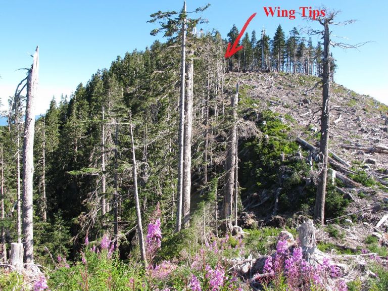
In 1944 a Patrol Plane crashed near the top of Mt Boldoc, south of Cowichan Lake, near Gordon River. The plane struck the summit of Mt Bolduc, where the tips of the wings were torn off, it then continued over a gully and crashed into a lower summit.

Access: Go to Cowichan Lake, west of Duncan. Go to the end of the paved lake south road, past Mesachie Lake, past Honeymoon bay – where it turns into a major logging road. Go south on the logging road to Gordon River. Just before Gordon River camp (basically and Orange smashed up car on the side of the road), take the left turn off – this is Harris Main. Go along about 1/2 km to a right hand turn on Mt Boldoc Forest Service Road. Drive up and up as far as you can go, near the top, a spur will take a sharp left, follow this up and around the summit. When the road turns to fresh blast rock keep your eyes peeled for flagging on the left. Ornage and yellow flagging in the trees (see picture below). Pay very close attention – I drove by it twice.
NOTE: if you want to find the wing tips, you will have to go further along the road, near its end. Hike through the slash to the top of the mountain. At the point where the clearcut meets the forest at the gulley, walk into the woods. There are two wing tips, one wigher up almost at the top, and another, a little wasy down into the gulley.
Ride Time: about 1-1/2 to the top from Cowichan Lake. The hike in takes about 5 minutes.
Difficulty: Easy logging roads. Short trail from logging road to the engines and main crash area. If you want to see the wing tips you will have to drive up the road further and hike through slash up to the summit of the mountain.
Map:
Here is a map which shows the route from Gordan River. You can get at Gordon River from Cowichan Lake or from Port Renfrew.
GPS File:
Mt Bolduc Plane Crash.gpx
See Also:
http://www.ww2f.com/living-history/36316-mt-bolduc-crash.html
http://www.cowichanlake.ca/bus/forestcoop/crashsite.html
http://www.waymarking.com/waymarks/WMAE_Mount_Bolduc
Approaching Gordon River Camp. Harris Main is to the left. Gordon River to the right. On Harris Main, there is a sign that says “TR7″, but that’ll probably be blown to bits later this summer.


